Project Preferences
Wildlife Insights is built to meet your needs! Learn how you can customize the platform for your projects.
View identifications by common name or scientific name
The default display for identifications is to show scientific names. You can also choose to view identifications by common name. To select this option:
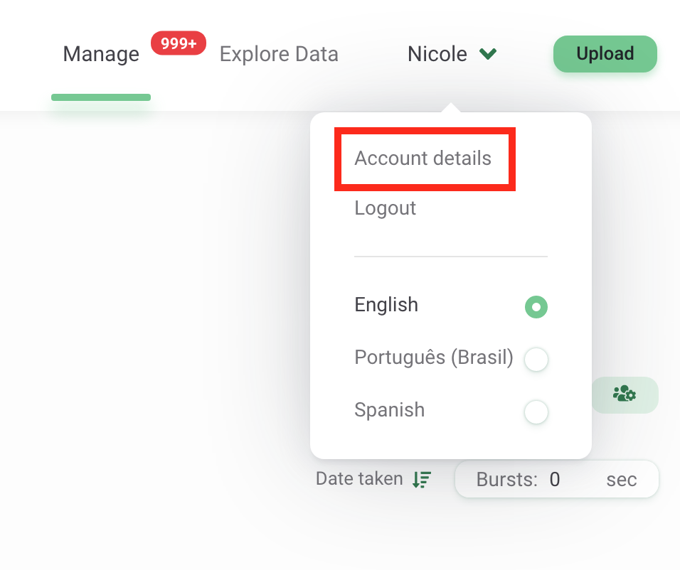
- Navigate to your Account details page by clicking on your name in the top right-hand corner of the screen
- Click on Account details to access your account details and preferences
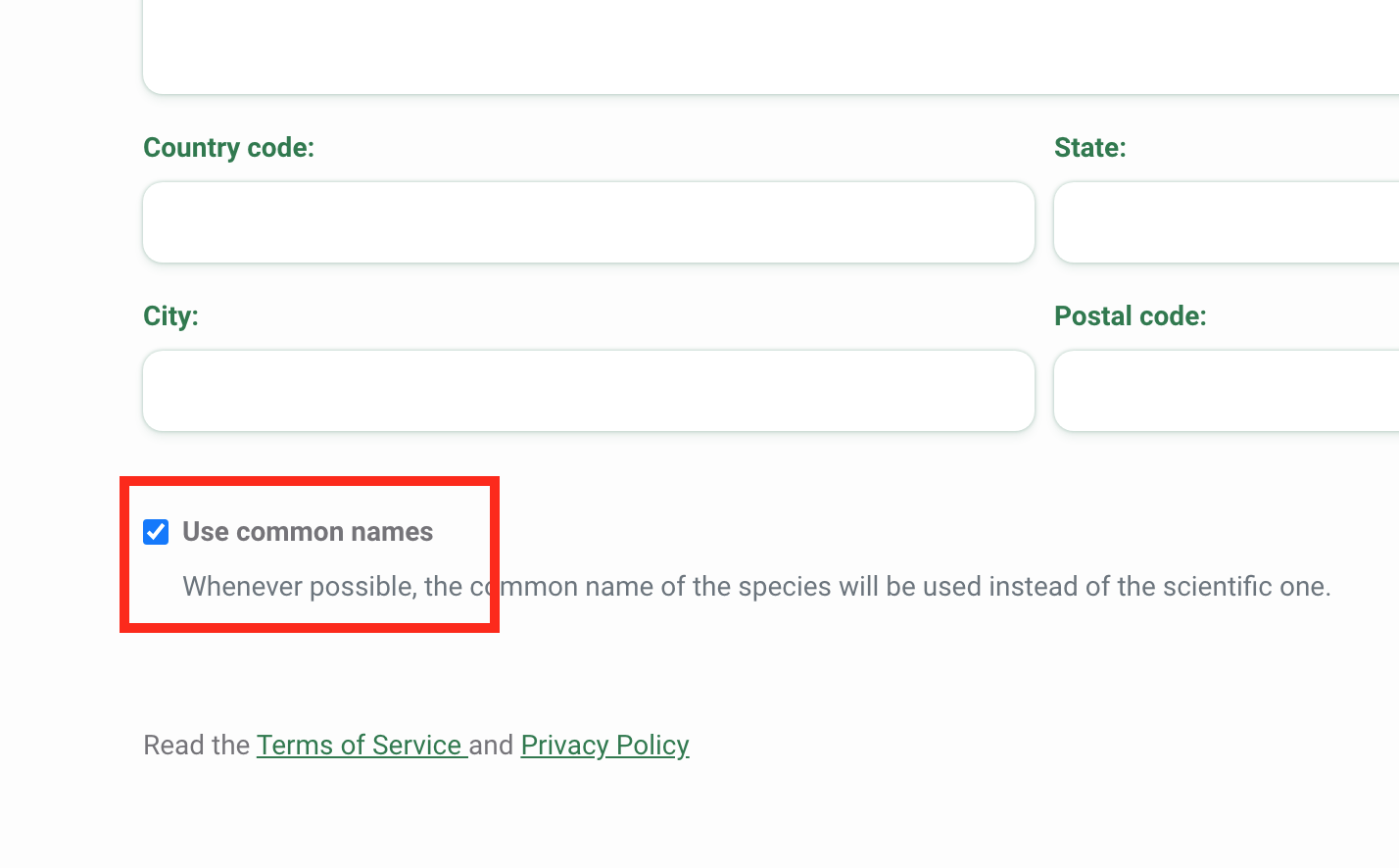
- At the bottom of the screen, you’ll see a tick box to Use common names.
- When the tick box is checked, you will see common names displayed in the identification interface and will be able to search filters using the common name.
- When the tick box is not checked, you will see the scientific name used in these instances.
- Click on Save Changes to save your changes.
Delete all images displaying humans from a project
There are several options available to remove or hide images of humans in your project.
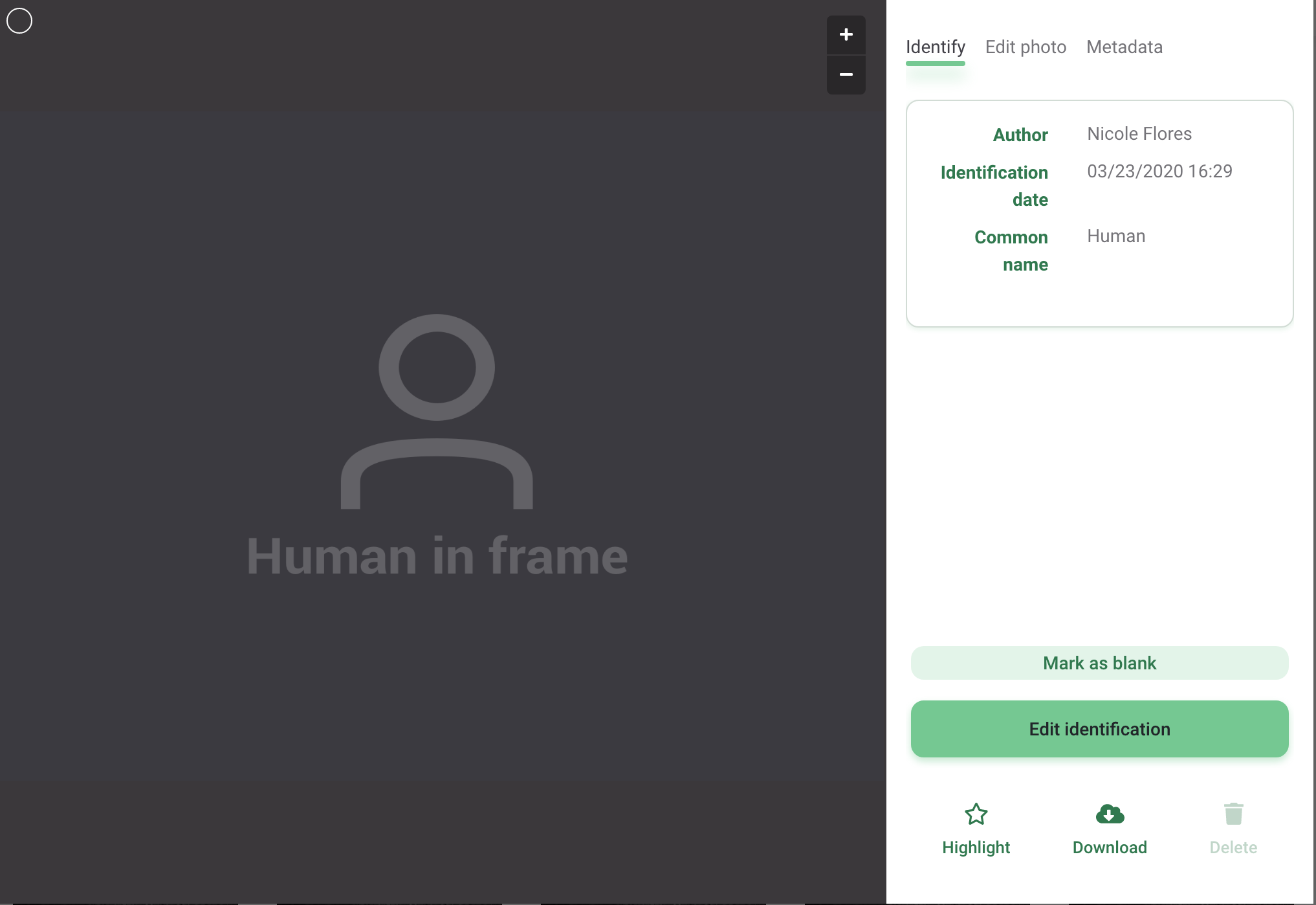
All images of humans will be visible in the Identify tab so that a user can confirm the identification.
By default, once an identification is confirmed with any human identification*, the image will not be visible on the Catalogued tab by any user with a project editor or viewer role. In lieu of the image, project editors and viewers will see a placeholder image (shown below).
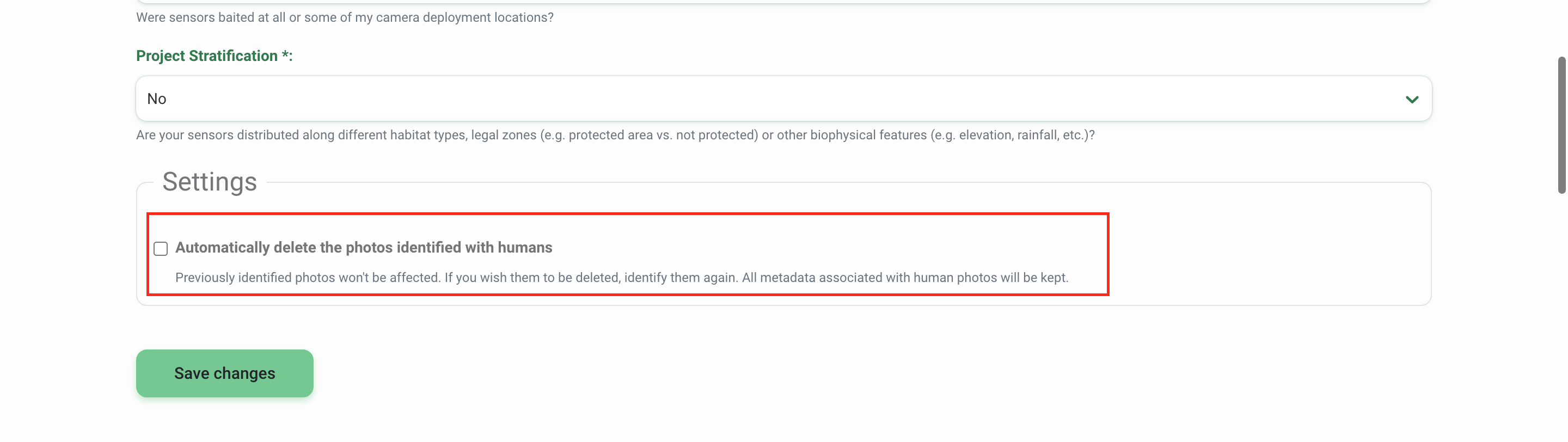
You can also choose to delete images with human identifications* from your project so that none of the users in your project can see images of humans. To select this option:
- Navigate to the Project Details page
- Scroll down to the Settings box
- Click the tick box next to the option to Automatically delete photos identified with humans.
- Click on Save Changes
*Human identifications include the following options:
- Human (Homo sapiens)
- Human-camera trapper
- Human-hunter
- Human-researcher
- Human-pedestrian
- Human-maintenance crew
- Human-park ranger
- Human-resident
- Human-tourist
Customize your project citation
Wildlife Insights automatically generates a citation for each project using the names of the project owners. To ensure you’re provided credit for use of your data, the citation is made available in each download package and on your project’s Public Details page. If you’d like to override the names used, you can enter this information on the Project Details page in the Credit Line field. Learn more about Citations.
Embargoes
All data submitted to Wildlife Insights will be made publicly available unless it is embargoed. The images and metadata from embargoed projects will be private for the duration of the embargo, but project details will still be made available on the Explore page. If you’d like to embargo your data, please enter the embargo time in the Project Details page. Learn more about Embargoes.
 Back to the guide